- News
- City News
- mysuru News
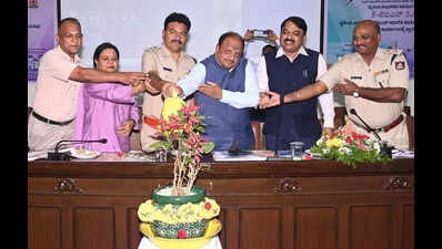
- GIS workshop highlights K-GIS 2.0 role in governance
Trending
GIS workshop highlights K-GIS 2.0 role in governance
Get real-time updates and result insights on the UP Board Result 2026, UP Board 10th Result 2026 and UP Board 12th Result 2026
You Can Also Check: Gold Rate in Mysuru | Silver Rate in Mysuru | Bank Holidays in Mysuru | Public Holidays in Mysuru
End of Article
Follow Us On Social Media

Hot Picks
Top Trending
Tired of too many ads?go ad free now
Trending Stories
In City
Entire Website
- Daughter of sr official raped, killed at S Delhi home by former help
- ‘Raped another woman in Rajasthan’: Chilling details emerge in IRS officer’s daughter murder case; how horror unfolded at south Delhi home
- 3 Noida protesters can’t file for bail, await arrest memo
- 'Explain in 24 hours': EC notice to Mallikarjun Kharge for calling PM Narendra Modi 'terrorist'
- 27L under scrutiny, 139 cleared to vote in Bengal Phase 1 polls
- Dalit groom pulled off horse, beaten during pre-wedding procession in Madhya Pradesh
- ‘Stabbed multiple times on head, neck, back and face’: Maharashtra woman kills former boyfriend’s wife
- Tamil Nadu polls: Stalin holds edge, but dark horse Vijay keeps rivals guessing
- Ranya Rao gold smuggling case: Kannada actor walks out of jail after 1-year detention
- Bengaluru 'BDSM' horror: As lover 'drifted back' to ex, woman staged intimate game, then turned it into murder trap
- West Bengal Election Voting 2026 Live Updates: Final campaign blitz ends in fierce TMC vs BJP showdown
- Israeli drone dropped grenade on rescuers aiding wounded journalist, says Lebanon
- UP Board 12th Result 2026 Live Updates: UPMSP Inter results releasing tomorrow at 4 PM; check official websites, steps to download scores on TOI portal
- UP Board 10th Result 2026 Live Updates: UPMSP Class 10 scorecards releasing on April 23, official notice issued, here's how you can download scorecards from website, DigiLocker and other apps
- CBSE Class 12 Result 2026 Live Updates: Expected date, how to check scores, pass criteria, and result download details
- UP Board Result 2026 Live Updates: Results to be declared on April 23 at 4 pm, result link to be available soon; check steps to download scorecards
- Daughter of sr official raped, killed at S Delhi home by former help
- IPL: Archer pockets 3 wickets to help RR beat LSG by 40 runs
- Delhi shocker: IRS officer’s daughter strangled with charging cable inside Amar Colony house; role of former house help suspected
- Tamil Nadu Polling Day Curbs: State declares holiday, dry days; banks shut, hospitals run
Tired of too many ads?go ad free now


Explore Every Corner
Across The Globe
US Iran War NewsWest Bengal election 2026LSG vs RR HighlightsUP Board 10th ResultCBSE 12th Result 2026Tamil Nadu election 2026UP Board ResultStock Market TodayUP Board 12th ResultUPMSP Board 12th ResultUPMSP Board 10th ResultDana WhiteVaibhav SooryavanshiNFL Trade RumorsTaylor SwiftLauren KyleDianna RussiniH1B Visa HoldersIPL 2026 Orange CapSouth Delhi Murder NewsKSEAB SSLC 10th ResultIPL Purple Cap 2026Sensex TodayPuka NacuaAmanda Anisimova Net WorthKavya MaranMS DhoniIPL 2026 Points TableIPL 2026 NewsIPL Schedule 2026

Hot on the Web
Ajay Jadeja HouseRanveer SinghVinod SuryavanshiRajpal YadavMaya Angelou QuoteParesh RawalMumtazBhoot Bangla ReviewShah Rukh KhanRakesh BediBhooth Bangla Box Office CollectionDivyanka SirohiAllu ArjunBhooth Bangla ReviewShah Rukh KhanAkshay KumarLIK CollectionDacoit Box Office CollectionJohn Ternus Net WorthRanya RaoSara ArjunDhurandhar 2 Box Office CollectionBhooth Bangla Movie ReviewDavid DhawanLeo TolstoyCriminal Record Season 2 ReviewDhurandhar 2 ReviewDhurandhar 2 CollectionMovierulzHoroscope TodayToday Gold Rate in ChennaiDelhi Weather TodayDelhi AQI TodayMumbai AQI TodayMaharashtra Public Holidays 2026Robot Wins Beijing Half MarathonApple WWDCBus Sized AsteroidSridhar VembuGarena Free Fire Max Redeem CodesKing Legacy Codes
Trending Topics
NTA CUET PG 2026 Exam ResultIPMAT Admit Card 2026Rohit SharmaAlastair CookRMLAU Result 2026NIFT Stage 2 ExamUK Pet Travel RulesUK Facial Recognition NewsShehbaz SharifJKBOSE ResultVaibhav SooryavanshiMike VrabelKarnataka SSLC Class 10th ResultNEHU Result 2026Tamil Nadu Elections 2026h1b visaIPL 2026illegally advertising in LondonCJ Gardner JohnsonTop Stock RecommendationsGold Rate TodayKarnataka US Tourist RapeTCS Nashik CaseStock Market TodayYoung TrumpDelhi Terror AttackTamil Nadu Cracker Unit BlastHyderabad Techie ArrestAshok KharatBihar College NewsUFCHailee SteinfeldDeen The GreatAllahabad High CourtPappu YadavMamata BanerjeeAryna Sabalenka FiancéNFL Trade RumorsSupreme CourtEarth DayNHL Trade
Popular Categories
HeadlinesSports NewsBusiness NewsIndia NewsWorld NewsBollywood NewsHealth+ TipsIndian TV ShowsTechnologyTravelEtimesHealth & FitnessAstrologyInternational SportsDeorhiTechnology NewsAutoWeather TodayGold Rate Today DelhiSilver Rate TodayPlatinum Rate TodayIs Bank open todayVirat Kohli IPL StatsHardik Pandya IPL StatsBank HolidaysPublic HolidaysBank Holidays AprilPublic Holidays AprilAries HoroscopeGemini Horoscope
Trending Videos
“Trail Of Terror Revealed”: India EXPOSES Pak Over Terror Links At Washington EventArmy Chief’s Hawaii Visit Highlights Deepening India-US Military Strategy In Indo-PacificUS Blockade of Iran Faces Challenges as Oil Traffic Continues Through Strait of HormuzKash Patel Contradicts Own Lawsuit In Heated Clash With Reporter Over Login Issue Bill Gates Faces New Scrutiny As Epstein Network Probe Reaches Gates FoundationZelensky's Fate Sealed? Putin Drops Bombshell, Declares ‘ENDGAME’ & 'VICTORY' In Ukraine | WATCHIndia Denies Crypto Scam Claims After Ship Fired Upon in Strait of Hormuz Tensions
Latest News
Hazaribag man drowns while fishing in lake"Behen Darr Gayi!": Fans relive ‘Bhagam Bhag’ era after watching Akshay Kumar's 'Bhooth Bangla' trailerMBOSE HSLC result 2026 to release tomorrow: Check details hereIran war risk: JPMorgan CEO Jamie Dimon warns of oil shocks, sticky inflation and higher interest ratesMake your clutch last longer with these easy driving tips“Three-against-one situation”: El Rubius opens up on being “targeted” in MrBeast’s viral $1M challengeBihar BTSC lab assistant notification released for 1091 posts at btsc.bihar.gov.in; apply hereIPL craze costs techie Rs 1.46 lakh in fake RCB vs CSK ticket scamRaising “robot-proof” kids: Why creativity and curiosity matter more than everInside ‘Satguru Sharan’: Exploring Saif Ali Khan and Kareena Kapoor Khan’s Rs 100 crore Bandra homeHow selling Alaska in 1867 was a costly mistake for Russia'Hera Pheri 3 is coming': Paresh Rawal dismisses delay reports and reveals he will 'start shooting soon'US-Iran War: A daring rescue Hollywood blockbuster is on its way. Till then, pick your favourite from these 10 films on bringing someone home against all oddsKolkata team unveils fan mural at Rash Behari Avenue, celebrating city’s first loveHow US spread a lie to rescue a pilot of a jet shot down in IranNetflix unveils ‘VOID’, an AI model that can change a movie plotAI data centers are causing 'stress' not just to tech companies, but also private insurers"Trans women are.....": Clavicular’s viral moment with trans women sparks fresh conversation on internet culture
Copyright © 2026 Bennett, Coleman & Co. Ltd. All rights reserved. For reprint rights: Times Syndication Service